Grand Mesa Near Grand Junction, Colorado
Last reviewed: July 2026
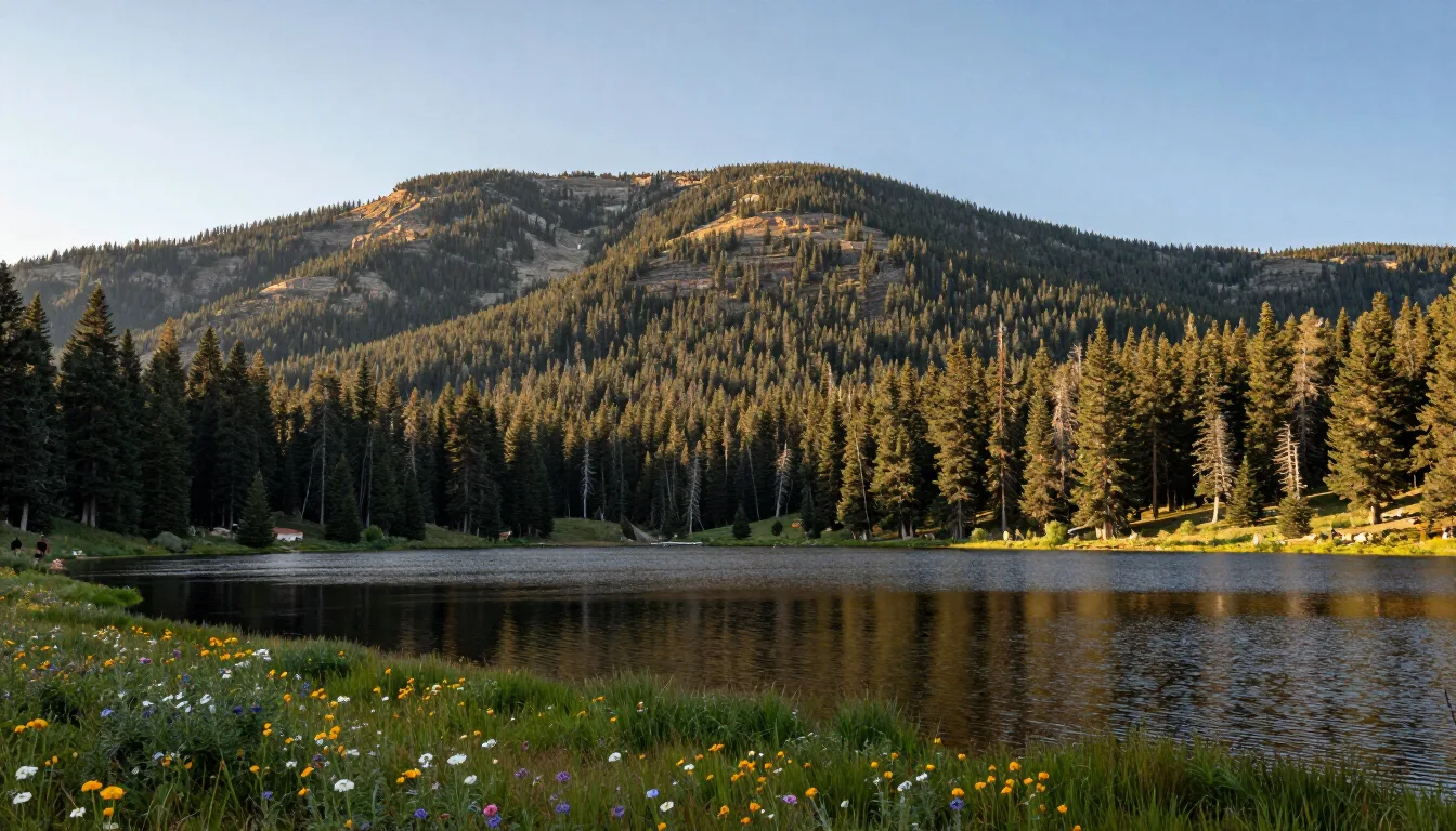
The Grand Mesa is the world’s largest flat-top mountain, rising to about 11,000 feet roughly an hour east of Grand Junction. It holds more than 300 lakes, cool spruce forest, the Grand Mesa Scenic Byway (Highway 65), Powderhorn ski resort, and summer camping, hiking, and fishing.
How do you get to the Grand Mesa from Grand Junction?
Drive east on I-70 to Exit 49 (Plateau Creek/Highway 65) and climb Highway 65 south onto the mesa — about 45 minutes to Powderhorn and roughly an hour to the Grand Mesa Visitor Center at Cedaredge Junction. Highway 65 is the Grand Mesa Scenic Byway, a paved, all-season route that gains close to 6,000 feet from the valley floor. As of July 2026 the byway is open year-round, but winter storms bring chain and traction laws; check trail & season status before you go.
What is there to do on the Grand Mesa in summer?
Summer on the mesa is about water, forest, and cool air: fishing and paddling the lakes, hiking the Crag Crest National Recreation Trail, camping in Forest Service campgrounds, and driving the byway for overlooks. Daytime highs typically run 25–30°F cooler than Grand Junction, which makes it the standard escape when the valley is in the 90s. Popular stops include Island Lake, Mesa Lakes, and the Land’s End Road overlook, which drops back toward the valley on a gravel route best driven in dry conditions.
How many lakes are on the Grand Mesa, and can you fish them?
The Grand Mesa holds more than 300 lakes and reservoirs, most of them small, shallow, and stocked. Trout — rainbow, brook, cutthroat, and splake in a few waters — are the draw, and shore fishing works on the majority of them. A Colorado fishing license is required for anglers 16 and older; buy one online through Colorado Parks and Wildlife or at a Grand Junction shop before you drive up, because coverage on the mesa is patchy. Island Lake, Mesa Lakes, Ward Lake, and Vega Reservoir (just off the mesa near Collbran) are the easiest to reach with a car and a pull-off. Small craft, float tubes, and kayaks are common; larger boats are practical mainly at Vega. Ice fishing takes over from roughly January through March, when snowmobiles and skis replace cars on the side roads. If you would rather fish moving water, the Colorado and Gunnison rivers in the valley are covered on our rafting and fishing page.
Where do you ski on the Grand Mesa?
Powderhorn Mountain Resort sits on the north flank of the mesa off Highway 65, about 45 minutes from downtown Grand Junction. It is the closest ski area to the city, with lift tickets and rentals well below I-70 resort prices and terrain that suits families and intermediates. The season generally runs mid-December into early April, snow permitting. Beyond the lifts, the Grand Mesa is one of Colorado’s better Nordic and snowmobile areas: the Grand Mesa Nordic Council grooms free cross-country trail systems at County Line, Skyway, and Ward Creek, and the mesa top holds a deep, long-lasting snowpack. Full details, drive-time comparisons with Telluride, Aspen, and Vail, and winter driving notes are on our Grand Junction skiing page.
What hiking and biking is there on the mesa?
The signature hike is the Crag Crest Trail, a National Recreation Trail that runs along a narrow volcanic ridge with lake and valley views on both sides; the full loop is roughly 10 miles and the ridge-only segment about 6.5 miles point to point, with the trailheads near Island Lake. Shorter, flatter options circle the Mesa Lakes and Ward Lake areas and work well with children. Mountain bikers are allowed on the loop’s lower section but not the crest itself; most valley riders stay on the Lunch Loops and 18 Road systems instead, then use the mesa for hiking. Snow lingers on the mesa top into June most years, so early-summer visitors should expect wet, muddy, or drifted trail sections and plan for afternoon thunderstorms, which build fast at 11,000 feet.
Where can you camp or stay on the Grand Mesa?
The Grand Mesa National Forest runs a string of small campgrounds along and near Highway 65 — Island Lake, Little Bear, Ward Lake, Cobbett Lake, Jumbo, and others — most open roughly from June once the snow clears until early fall. Sites are simple (vault toilets, no hookups), and popular weekends fill, so reserve where reservations are offered. A handful of rustic lodges and cabins operate on the mesa year-round, and Powderhorn has slopeside lodging in winter. Many visitors simply day-trip and sleep in town, where rates are lower and choice is wider — see Grand Junction hotels. Nights on the mesa are cold even in July, often dipping into the 30s and 40s, so pack a real sleeping bag and warm layers regardless of the valley forecast.
When is the best time to visit the Grand Mesa?
July through September is the reliable window: lakes are ice-free, campgrounds are open, wildflowers peak in July, and the aspens turn in late September. June can still hold snow and mud at the highest elevations. Winter belongs to skiing, snowshoeing, and snowmobiling, with Highway 65 plowed but often slick. Because the mesa runs 25–30°F cooler than the valley, it is the antidote to a hot Grand Junction afternoon — see weather by month and best time to visit. A mesa loop also makes an easy half-day or full-day outing on our day trips list, whether you drive up and back on Highway 65 or continue down to Cedaredge and return through Delta on US-50.
What should you know before driving up?
Fuel up in Grand Junction, Palisade, or Mesa; services on top are limited to a few seasonal lodges. Cell coverage is unreliable across most of the mesa, so download maps first. Afternoon thunderstorms are routine in July and August — be off exposed ridges like Crag Crest by early afternoon. Land’s End Road, the gravel route to the western rim overlook, is usually open midsummer through fall and closed by snow the rest of the year; it is passable in a standard car when dry but slick and rutted when wet. As of July 2026 there is no entrance fee for the national forest itself, though campgrounds and some day-use sites charge. Confirm current road, snow, and campground status on the trail & season status page or with the Grand Mesa Visitor Center before you commit to a long drive.
Frequently Asked Questions
The near edge of the Grand Mesa is about 45 minutes from downtown Grand Junction via I-70 east to Exit 49 and Highway 65. Powderhorn is about 40 miles, and the mesa-top lakes are roughly an hour.